Friday, September 7, 2012

Grandview Peak

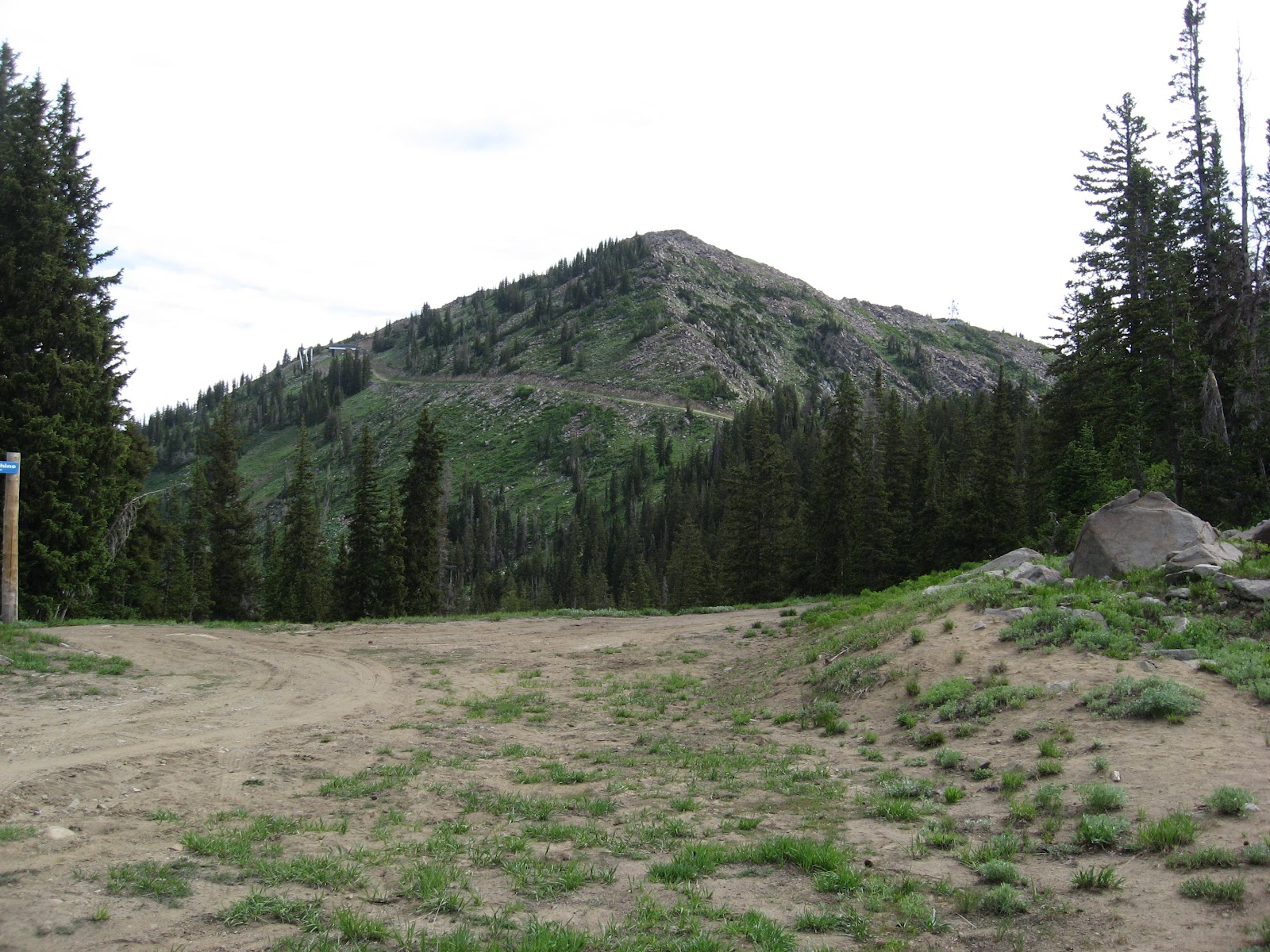
Grandview Peak is not a popular climb among the peaks of the Wasatch Range, mainly due to its remoteness and difficulty in accessing.  In the upper reaches of City Creek Canyon along the east slope of Grandview Peak's southern ridge, there is evidence of a massive rock slide that some scientists believe was triggered by an earthquake.  Other than this, there are no particular characteristics that make this mountain stand out from the other, more popular peaks, yet it sits as the highest point in Salt Lake County north of Parleys Canyon.  The hike described here involves mostly ridgeline hiking along part of the Great Western Trail, which technically extends from Canada to Mexico.  Since most of the trail is unshaded from the sun, it is important to use sunscreen and to bring plenty of liquids (at least one gallon) with you as there are no real sources of drinking water along the route.
To reach the starting point for this hike from Bountiful, take the 400 North (Exit 317) off of I-15 if coming from the south, or the 500 West (Exit 317) off of I-15 if coming from the north.  Turn east (towards the mountains) onto 400 North and stay in the right lane to continue past Main Street.  At the stop sign, turn left (north) onto 1300 East, and then right onto 600 North up the hillside.  Take another right onto Skyline Drive and follow it nearly a half-mile to Eagle Ridge Drive.  Now turn right onto Eagle Ridge Drive and follow it to the large parking lot near the end of the street.  For those who feel confident in taking their vehicles on dirt roads, take the paved road (which turns to dirt after several hundred yards) to the left of the parking lot immediately below the huge "B" for Bountiful.  Follow this road (also known as Skyline Drive) all the way up the mountainside to the saddle along the Davis-Morgan County line.  At approximately 8.3 miles from the parking lot, continue straight on the road past the fork to the left (west).  Just beyond the fork, the road makes a hairpin turn towards the south past another parking area.  While this section of road becomes less maintained than the previous stretch, you should be able to drive carefully on it for about 3.4 miles (past the gas pipeline crossing) to a parking point along the north edge of a wooded area.  The road actually continues about another 0.9 miles further to a trailhead, but this last stretch is quite rugged for vehicles.
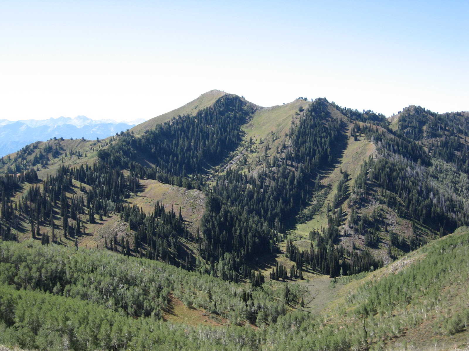
Grandview Peak as viewed along
the Sessions Mountain ridgeline
Survey monument cap at the
summit of Grandview Peak


Hiking along the unimproved road now, the route descends approximately 250 feet elevation into a small basin before ascending slightly to a knoll on the other side.  It then descends again to reach the trailhead at approximately 8,260 feet elevation.  The trail continues its way through mostly wooded country to reach the summit ridge of Sessions Mountain at approximately 9,000 feet elevation.  From this ridge, Grandview Peak comes into view one-and-a-half miles to the south-southeast.  As the trail heads generally east from this point, it drops about 400 feet to a saddle and then regains this same elevation on the other side.  The entire route along the East Sessions Mountain ridge (about 1.1 miles) is unshaded from the sun.  At a point near where three counties meet, the final leg of the route involves another drop of about 250 feet before the final ascent to the 9,410-foot summit of Grandview Peak is made.  While the initial elevation gain from the starting point to the summit of Grandview Peak is only 930 feet, several decreases and regains in elevation push this value to approximately 2,000 feet.  Total distance is approximately 5.0 miles one-way.
View looking southwest towards
the summit of Grandview Peak

Tuesday, July 24, 2012

Ferguson Canyon & Storm Mountain

Ferguson Canyon provides an enjoyable place to hike that's not as crowded as some of the trails up Big Cottonwood Canyon.  It is a popular destination for rock climbers to come and scale the cliffs near the mouth of the canyon.  Since dogs are allowed here, they often join their masters on the outdoor activities.  Further up the canyon, the trail switchbacks up the north ridge to an overlook of the Salt Lake Valley.  An eye-catching feature along the south rim of Ferguson Canyon is a rock formation known as the Hounds Tooth.  At the end of the canyon on the north ridge is Storm Mountain, which is actually a terminus point of the ridge extending northwest of Twin Peaks.  Northeast of Storm Mountain is Stairs Gulch where avalanches notoriously occur during the winter and early spring seasons.
To reach the Ferguson Canyon trailhead from Wasatch Boulevard, turn east (towards the mountains) onto Prospector Drive (7535 South).  Take an immediate right turn and continue south for approximately one-third of a mile to Timberline Drive (7780 South).  Turn left (east) on Timberline Drive and park along the right-side of the road near the beginning of the dirt service road.  Hike the service road northeastward past the water tank to reach the trailhead.  The trail makes a brief descent before ascending up Ferguson Canyon.  Upon reaching the rock climbing area just beyond the mouth of the canyon, the trail becomes a maze of other trails leading to various climbing sites.  Stay generally close to the streambed for the main trail through this area.  At approximately 1.2 miles from the starting point, the trail switchbacks several times for about 0.3 miles to an overlook of the Salt Lake Valley.  This is where I began my arduous climb up the south rim of the canyon to reach the Hounds Tooth.  While I'm not recommending this route as the best route to climb the Hounds Tooth, it was the most feasible for me at the time.  The slope is quite steep, and there were times when I had to cling to the shrubbery I was bushwhacking through to keep from sliding down the mountainside.  At the point when I was ready to abandon my wild attempt, I reached the top of the rim northwest of the Hounds Tooth.  On more level ground now with the goal in sight, I more or less made a direct course to the base of the formation.  The final obstacle came in climbing to the top of the rock without putting myself in too much danger.  After careful study, I followed a sloping ledge that seemed to be heavily vegetated near the south end of the formation.  Through careful maneuvering with some exposure, I was able to reach the 8,136-foot summit of Hounds Tooth.  Distance from the Ferguson Canyon starting point to the Hounds Tooth summit is approximately 1.9 miles one-way (based on the route I took) with an elevation gain of 2,886 feet.
Rock towers along the trail near
the Salt Lake Valley overlook
West face of the Hounds Tooth with
yellow line showing my general route


To continue on to Storm Mountain, follow the trail up the switchbacks past the Salt Lake Valley overlook.  At around 2.4 miles, the trail steepens for about 0.4 miles to reach a meadow area at approximately 8,300 feet elevation.  Beyond the meadow the trail becomes indistinguishable, and you make your way towards the pyramid-shaped peak on the left (north), which is Storm Mountain.  Near the base of the peak the route becomes steeper for a final scramble to the 9,524-foot summit of Storm Mountain.  During the time I did it, I looked across the Salt Lake Valley to see a thunderstorm looming on the west side.  Fearful of lightning, I finished a quick lunch and made my way off the Storm Mountain ridge.  While I got wet from rain a few times on the way down Ferguson Canyon, I never encountered any close lightning strikes.  What a coincidence to get caught in a storm on Storm Mountain!  Distance from the Ferguson Canyon starting point to the summit of Storm Mountain is approximately 3.5 miles one-way with an elevation gain of 4,274 feet.
The pyramidal shape of Storm Mountain
as viewed from the meadow area
View of an approaching thunderstorm
near the summit of Storm Mountain

Saturday, July 14, 2012

Broads Fork Meadows & Twin Peaks

The hike described here can range from relatively easy to rather difficult depending on your choosing.  For a pleasant hike to an area where there are impressive views of the surrounding peaks along with the soothing sound of flowing water, the Broads Fork Meadows is the place to go.  It provides a great place to have a picnic lunch and to simply get away from the hustle-bustle of city life for awhile.  The Broads Fork Canyon is also the main access to Twin Peaks, which are the highest points along the Cottonwood Ridge, separating Big and Little Cottonwood Canyons, and overlooking the Salt Lake Valley.  While these vantage points provide spectacular views of the valley below along with other points in the Wasatch Range, anyone attempting to climb the Broads Fork Twins should be in top physical condition and plan for a long day.
View of Dromedary, Sunrise, and part of
Twin Peaks from the lower meadow
area Photo credit: Eric Willhite
To reach the Broads Fork trailhead from the Salt Lake Valley, take the 6200 South (Exit 6) off of I-215 and turn right (at the light) onto Wasatch Boulevard (SR 190).  At Fort Union Boulevard (7200 South), turn left (east) to go up Big Cottonwood Canyon towards the Brighton and Solitude Ski Resorts.  At approximately 4.5 miles up the canyon, the "Mill B Trailhead" sign appears to your right (south) at the bottom of what's known as the S-Curve.  Parking is available near the trailhead, or a second parking lot is available in the upper bend of the S-Curve.  Early arrivals during weekdays tend to guarantee a parking spot in the parking lot.  The Broads Fork trail begins near the west corner of the lower parking lot and makes a moderately steep climb westward to an overlook at about 0.3 miles.  Near the overlook, it enters the Twin Peaks Wilderness Area and levels out some as it veers to the left (south) into Broads Fork Canyon.  The trail eventually crosses to the west side of the stream where the climb becomes steep in places until the lower meadow area is reached at approximately 8,220 feet elevation.  Just before the meadow, the trail splits with the left (east) fork leading to a large pond.  Distance from the Broads Fork trailhead to the large pond in the lower meadow area is approximately 2.3 miles one-way with an elevation gain of approximately 2,040 feet.
Beyond the pond, the trail leading towards Twin Peaks becomes less distinct, and may at times disappear.  Continue hiking in the direction of the intermittent streambed, which may involve several stream crossings depending on the time of year.  Eventually, a terraced slope will begin to rise to the left (east) of the streambed.  This rather steep slope leads to an upper meadow area that levels out at about 9,600 feet elevation.  Here is a good spot to rest before pressing onward.  From the upper meadow, the route becomes a scramble over seemingly endless rock towards the saddle to the southwest.  Snow often remains in this area well into the summer months, and it is wise to carry along some crampons and an ice axe should you need them.  When walking on the snow, however, be aware of hidden voids that may collapse beneath you.  The terrain becomes steeper as you approach the saddle with various small cliff bands to work around.  Once the 10,800-foot saddle is reached, you can rest assured that the most grueling part of the climb is behind you.  Continuing northwest along the saddle ridge, you will run into one more obstacle during the final ascent.  It is a sloping rock wall on the Little Cottonwood side of the ridge with a one-foot irregular ledge spanning most of the way across it.  At the end of the ledge is a crack, perhaps 30 feet high, where there are holding points to wedge your hands and feet to pull yourself up.  This can be accomplished at a slow, steady pace if you're not too frightened of heights.  Beyond the crack, it's a standard scramble the remaining distance to the 11,330-foot summit of East Twin Peak.  The east summit is only two feet higher than the west summit, and they are approximately 0.14 miles hiking distance from each other.  While some sources place the one-way distance as high as 5.0 miles, based on my calculations, it is approximately 4.5 miles one-way from the Broads Fork trailhead to the summit of Twin Peaks.  Elevation gain from the trailhead is 5,130 feet.
West Twin Peak from the summit of
East Twin Peak
The wall & crack area on the
final ascent of Twin Peaks

East Twin Peak from the summit of
West Twin Peak

Friday, June 29, 2012

Clayton Peak

One of the easiest 10,000-foot peaks to climb in the Wasatch Range is Clayton Peak at the end of Big Cottonwood Canyon.  This peak straddles the Salt Lake-Wasatch County line near the upper terminus of the Great Western Express ski lift at the Brighton Resort.  It is one of the few vantage points where six world-class ski resorts can be viewed at once.  Clayton Peak also offers spectacular views of the Heber Valley, Mount Timpanogos, and the Uinta Mountains to the east.  During the time we went up, there happened to be a team of Varsity Scouts at the summit, signaling other scouts with mirrors on some of the surrounding peaks.  Clayton Peak can be hiked from basically two starting points; the Lake Mary-Catherine Pass trailhead near the southeast edge of the parking lot at Brighton Ski Resort, and the summit at Guardsman Pass to the north of Clayton Peak.
To reach the Lake Mary-Catherine Pass trailhead from the Salt Lake Valley, take the 6200 South (Exit 6) off of I-215 and turn right (at the light) onto Wasatch Boulevard (SR 190).  At Fort Union Boulevard (7200 South), turn left (east) to go up Big Cottonwood Canyon towards the Brighton and Solitude Ski Resorts.  Continue driving all the way to the end of the canyon to the Brighton Ski Resort parking area (about 14.6 miles).  The trail begins at an information board not far from some resort structures.  During the first part of the climb, various service roads that lace through the area will be encountered, making it easy to become sidetracked if you're not paying attention to the general trail path.  At around 0.8 miles the trail splits; the left fork goes towards Dog Lake (not the Dog Lake described in the previous post) and the right fork goes to Lake Mary.  If more time is available, the extra quarter-mile hike to Lake Mary is certainly worth the effort.  To continue on to Clayton Peak, however, the left fork towards Dog Lake is taken.  This route continues through a generally forested area for about 1.3 miles to reach Snake Creek Pass, where the Heber Valley area comes into view.  Follow the service road that leads northwestward towards the base of Clayton Peak.  Upon reaching the base, the trail picks up again for a rocky ascent through a series of switchbacks to the 10,721-foot summit.  Distance from the Lake Mary-Catherine Pass trailhead to Clayton Peak is approximately 2.7 miles one-way with an elevation gain of approximately 1,950 feet.
Clayton Peak as viewed from
Snake Creek Pass
At the summit of Clayton Peak with
Mount Timpanogos directly behind me –
Photo credit: Joe Harline


For those interested in climbing Clayton Peak from Guardsman Pass, the road to Guardsman Pass splits to the left (east) from the main highway at about 13.9 miles up Big Cottonwood Canyon.  Follow this road through several switchbacks for approximately 3.1 miles to reach Guardsman Pass at 9,700 feet elevation.  The trail from this direction ascends a steep ridge towards the southwest, and involves skirting around the right (west) side of a false summit (10420) to reach Clayton Peak.  Distance from Guardsman Pass to Clayton Peak is approximately 1.4 miles one-way with an elevation gain of 1,021 feet.

Wednesday, June 13, 2012

Dog Lake & Lake Desolation

Another easy to moderate hike up Big Cottonwood Canyon is the Mill D North Fork trail to Dog Lake and Lake Desolation.  This is a popular area for mountain bikers, particularly on the even-numbered calendar days, so keep an eye out for them and be considerate.  Weekdays are generally less crowded than the weekends to hike on the trail.  During the winter months, it is not unusual to see snowshoeing and cross-country skiing in the area.  Dog Lake and Lake Desolation are approximately 2.5 miles hiking distance from each other, and can be hiked within the same trip given sufficient time.
The trailhead at Mill D North Fork is reached from the Salt Lake Valley by taking the 6200 South (Exit 6) off of I-215 and turning right (at the light) onto Wasatch Boulevard (SR 190).  At Fort Union Boulevard (7200 South), turn left (east) to go up Big Cottonwood Canyon towards the Brighton and Solitude Ski Resorts.  Continue driving for approximately 9.0 miles up the canyon to the Mill D North Fork turn-out area located left (north) of the highway across from the Jordan Pines turn-off.  The trail ascends Reynolds Gulch very briefly before veering to the right (eastward) to curve around the mountain towards Mill D North Fork Canyon.  Resort homes will appear across the stream near the mouth of the canyon while approaching it.  In the canyon beyond the resort home area, the trail reaches the Mill D North Fork streambed, which varies in water flow depending on the season.  After approximately 1.7 miles the trail splits; the left trail going to Dog Lake (another 0.6 miles) while the right trail goes to Lake Desolation (another 1.9 miles).  A spring lies downhill from the point where the trail splits.
Dog Lake as viewed from the north; dogs
are allowed at Dog Lake from Mill Creek
Sign where the trail splits to
Dog Lake and Lake Desolation


The trail to Dog Lake ascends a moderately steep drainage that levels out some just before reaching the lake at approximately 8,735 feet elevation.  Unlike most surrounding lakes in the Wasatch Range, Dog Lake lies in the midst of a forest instead of a cirque.  While dogs are permitted at this lake, they can only be brought in from the Mill Creek side.  No dogs are allowed in Big Cottonwood Canyon due to the area being a vital watershed for the Salt Lake Valley.  Anyone caught with a dog beyond the warning signs near the south perimeter of Dog Lake could face a hefty fine.  Distance from the Mill D North Fork trailhead to Dog Lake is approximately 2.3 miles one-way with an elevation gain of approximately 1,450 feet.

Continuing along the trail to Lake Desolation (or Desolation Lake to some), the route makes a moderately steep climb northward and then levels out some after veering in more of an easterly direction.  Occasional meadows appear along this stretch and the surrounding peaks become more visible the closer you get to Lake Desolation.  A final climb comes about 0.5 miles before the lake while ascending the northwest rim of the basin where the lake lies.  The trail continues beyond Lake Desolation to join with the Great Western Trail, which provide spectacular views of the surrounding landscape.  From the northwest rim, a descent of about 50 feet is made to reach the shore of the lake at approximately 9,200 feet elevation.  Distance from the Mill D North Fork trailhead to Lake Desolation is approximately 3.6 miles one-way with an elevation gain of a little less than 2,000 feet.
Approaching Lake Desolation
from the northwest
Warning sign near the south perimeter of
Dog Lake  warning of no dogs or horses

Thursday, March 8, 2012

Gobblers Knob & Mount Raymond

For those desiring a more moderate hike, the trail up Butler Fork to Gobblers Knob and Mount Raymond achieves this objective.  These two peaks are the highest points along the ridge that separates Mill Creek Canyon from Big Cottonwood Canyon Gobblers Knob being a mere five feet higher than Mount Raymond.  This ridge forms part of the boundary of the Mount Olympus Wilderness Area, which currently excludes the Alexander Basin area to the north.  Gobblers Knob and Mount Raymond are often climbed within the same hike since the two summits are within 1.5 miles of each other.  While this area can be hiked anytime of the year, autumn is a particularly delightful time due to the cooler temperatures and the leaves changing color.
To reach the trailhead at Butler Fork from the Salt Lake Valley, take the 6200 South (Exit 6) off of I-215 and turn right (at the light) onto Wasatch Boulevard (SR 190).  At Fort Union Boulevard (7200 South), turn left (east) to go up Big Cottonwood Canyon towards the Brighton and Solitude Ski Resorts.  Continue driving for approximately 8.2 miles up the canyon to the Butler Fork turn-out area located left (north) of the highway.  On most days there should be plenty of parking in this area.  The trail follows Butler Fork for the first 1/2 mile before forking left (west) up a gully to a ridge overlooking Mill A Gulch.  Several switchbacks are encountered before reaching the ridge.  Once on the ridge, the trail levels out some until Mill A Basin at the foot of Mount Raymond.  From here the trail forks right towards Baker Pass (north) at approximately 9,350 feet elevation.  At the pass, you can choose which peak you want to climb first.  I chose Gobblers Knob first because of its slightly longer distance to reach the higher summit.  There are actually two summits on Gobblers Knob; the southwest summit is 22 feet lower than the higher 10,246-foot northeast summit.  For climbing Mount Raymond, the ridge is a little more exposed and requires more careful traversing to reach the 10,241-foot summit.  Distance from the trailhead to Gobblers Knob is approximately 4.1 miles one-way with an elevation gain of 3,126 feet.  To Mount Raymond, the distance is approximately 3.9 miles one-way with an elevation gain of 3,121 feet.
The twin summits of Gobblers Knob
from the summit of Mount Raymond
Mount Raymond (left) and the Salt Lake
Valley from the summit of Gobblers Knob


Saturday, March 3, 2012

Donut Falls

A favorite hike for many that is suitable for the entire family is Donut (often spelled Doughnut) Falls, which is up the Mill D South Fork of Big Cottonwood Canyon.  It is a great hike for individuals who don't want to spend a lot of time necessary for longer, more strenuous hikes.  Unfortunately, the falls have lost some of their pristine beauty in recent years due to rock fall in the area.  Donut Falls is so named because the water cascades through a hole in the rock that looks like a donut hole when viewed from below.  In 2007 the City of Salt Lake purchased Donut Falls from private ownership along with about 144 acres of surrounding land in an effort to protect the city's watershed.

To access the Donut Falls trailhead from the Salt Lake Valley, take the 6200 South (Exit 6) off of I-215 and turn right (at the light) onto Wasatch Boulevard (SR 190).  At Fort Union Boulevard (7200 South), turn left (east) to go up Big Cottonwood Canyon towards the Brighton and Solitude Ski Resorts.  Continue driving for approximately 9.0 miles up the canyon to the Jordan Pines picnic area, and turn right (south) onto the paved turn-off.  The trailhead is at the south end of a parking lot about one mile down this turn-off past the Jordan Pines picnic area and some private property.  A well-marked trail covers the first 0.4 miles of the hike before it crosses a stream to an old dirt road.  Follow this road upward for about 1/4 mile or so until the trail veers to the left (east) a little towards the narrowing canyon.  Upon reaching the stream area, a small steep slope into the streambed is encountered, which will require a helping hand for young children to get across.  The viewing area just below Donut Falls is approximately 7,820 feet in elevation.  Hiking in the grotto area and around the waterfall itself is discouraged due to the slippery wet conditions, the dislodging of rocks, and causing further damage to the unique character of the waterfall.  Distance is approximately 0.75 miles one-way with an elevation gain of 360 feet from the parking lot.
A group of young women hike in
the area just below Donut Falls
Close-up of Donut Falls  Photo
credit: Adventuretainment TV