Deseret Peak is perhaps my favorite hike to an 11,000-foot peak. Situated approximately 45 miles southwest of Salt Lake City (as the crow flies), Deseret Peak sees fewer hikers than the more popular peaks of the Wasatch Range. In 1984, over 25,000 acres of land in the Stansbury Mountains were designated as the Deseret Peak Wilderness Area by the U.S. Congress. Its unique beauty is beyond anything you would normally expect to see in Tooele (pronounced "too-ill-uh") County. While guide books often describe the remains of an old heliograph station at the summit, further research since this posting reveals that it was actually a U.S. Coast & Geodetic station used in the early surveying of the Western United States (refer to first comment below). The old rock walls can provide some shelter from the wind on breezy days. No specialized equipment is needed to climb Deseret Peak during snow-free conditions.

To reach the trailhead for Deseret Peak from I-80, take the Tooele City exit (Exit 99) onto SR 36 if coming from the east, or the Grantsville exit (Exit 84) onto SR 138 if coming from the west. Once off the freeway on the Tooele exit, follow SR 36 for about 3.0 miles and turn right (west) onto SR 138 towards Grantsville. Follow SR 138 (approximately 11.0 miles) through downtown Grantsville and turn left (south) onto West Street near the west edge of town. From the Grantsville exit, follow SR 138 for approximately 9.0 miles and turn right (south) onto West Street near the beginning of town just after the highway curves left (east). Head south for about 5.2 miles on West Street, which turns into Mormon Trail, and then turn right (westward) onto the road leading to South Willow Canyon. This road is paved to the forest boundary (approximately 3.3 miles) and turns to a maintained dirt road the remaining distance to the Loop Campground. Two unique features in South Willow Canyon are the Upper and Lower Narrow areas, which often attract rock climbers. During seasons with heavy runoff, the road has sometimes been washed out in these areas from high water
– so check with the Forest Service and plan accordingly.
 |
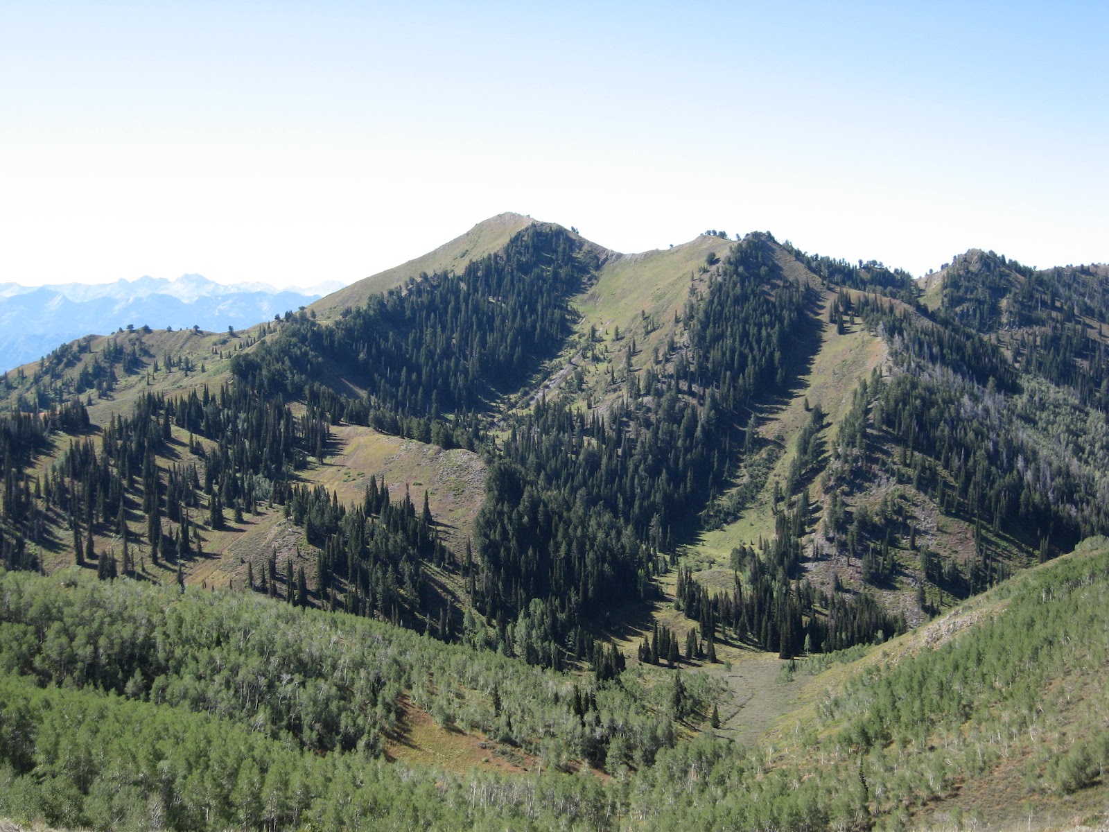
View of Deseret Peak taken from
the east viewpoint area (see map) |
The trail begins near the restrooms at the top of the Loop Campground and enters the wilderness area after several hundred feet or so. Since horses are allowed on the trail, watch out for the occasional "surprises" left behind. At approximately 0.7 miles, the trail crosses the streambed and splits; the left trail ascends up the Mill Fork of South Willow Canyon while the right trail ascends over a ridge into the Pockets Fork of South Willow Canyon. If you're planning to hike the entire loop, it matters not really which direction you take to reach Deseret Peak. The shortest route, however, and the one I normally take is the Mill Fork route, which continues for another 2.2 miles past the junction point to a saddle along the summit ridge. Upon reaching the end of the canyon, the trail becomes steeper and several switchbacks are encountered before reaching the saddle at just over 10,000 feet elevation. On the saddle with time permitting, a brief hike (perhaps two thirds of a mile over and back) can be taken on relatively level ground to a viewpoint off to the east where great views of Deseret Peak and points east can be had. Continuing on to Deseret Peak, the main trail forks to the right (west) up a steep slope, and then veers to the south. Snow can sometimes remain in this area well into the summer months – so plan accordingly. Once the south shoulder of the summit ridge is reached, the trail veers westward again and climbs near the top of two north-facing couloirs, or steep gullies in the mountainside. From this point only a short climb remains to the 11,031-foot summit of Deseret Peak. Distance from the trailhead to the summit of Deseret Peak is approximately 3.7 miles one-way via the Mill Fork route, or approximately 4.3 miles one-way via the Pockets Fork route. Elevation gain to the summit is 3,613 feet from the trailhead.
 |
A rock face looms ahead near
the summit of Deseret Peak |
 |
Snow at the top of the twin couloirs
near the summit of Deseret Peak |
 |
Boy Scouts pose at an old survey
station at the summit of Deseret Peak |