
To reach the starting point for this hike from Bountiful, take the 400 North (Exit 317) off of I-15 if coming from the south, or the 500 West (Exit 317) off of I-15 if coming from the north. Turn east (towards the mountains) onto 400 North and stay in the right lane to continue past Main Street. At the stop sign, turn left (north) onto 1300 East, and then right onto 600 North up the hillside. Take another right onto Skyline Drive and follow it nearly a half-mile to Eagle Ridge Drive. Now turn right onto Eagle Ridge Drive and follow it to the large parking lot near the end of the street. For those who feel confident in taking their vehicles on dirt roads, take the paved road (which turns to dirt after several hundred yards) to the left of the parking lot immediately below the huge "B" for Bountiful. Follow this road (also known as Skyline Drive) all the way up the mountainside to the saddle along the Davis-Morgan County line. At approximately 8.3 miles from the parking lot, continue straight on the road past the fork to the left (west). Just beyond the fork, the road makes a hairpin turn towards the south past another parking area. While this section of road becomes less maintained than the previous stretch, you should be able to drive carefully on it for about 3.4 miles (past the gas pipeline crossing) to a parking point along the north edge of a wooded area. The road actually continues about another 0.9 miles further to a trailhead, but this last stretch is quite rugged for vehicles.
 |
| Grandview Peak as viewed along the Sessions Mountain ridgeline |
 |
| Survey monument cap at the summit of Grandview Peak |
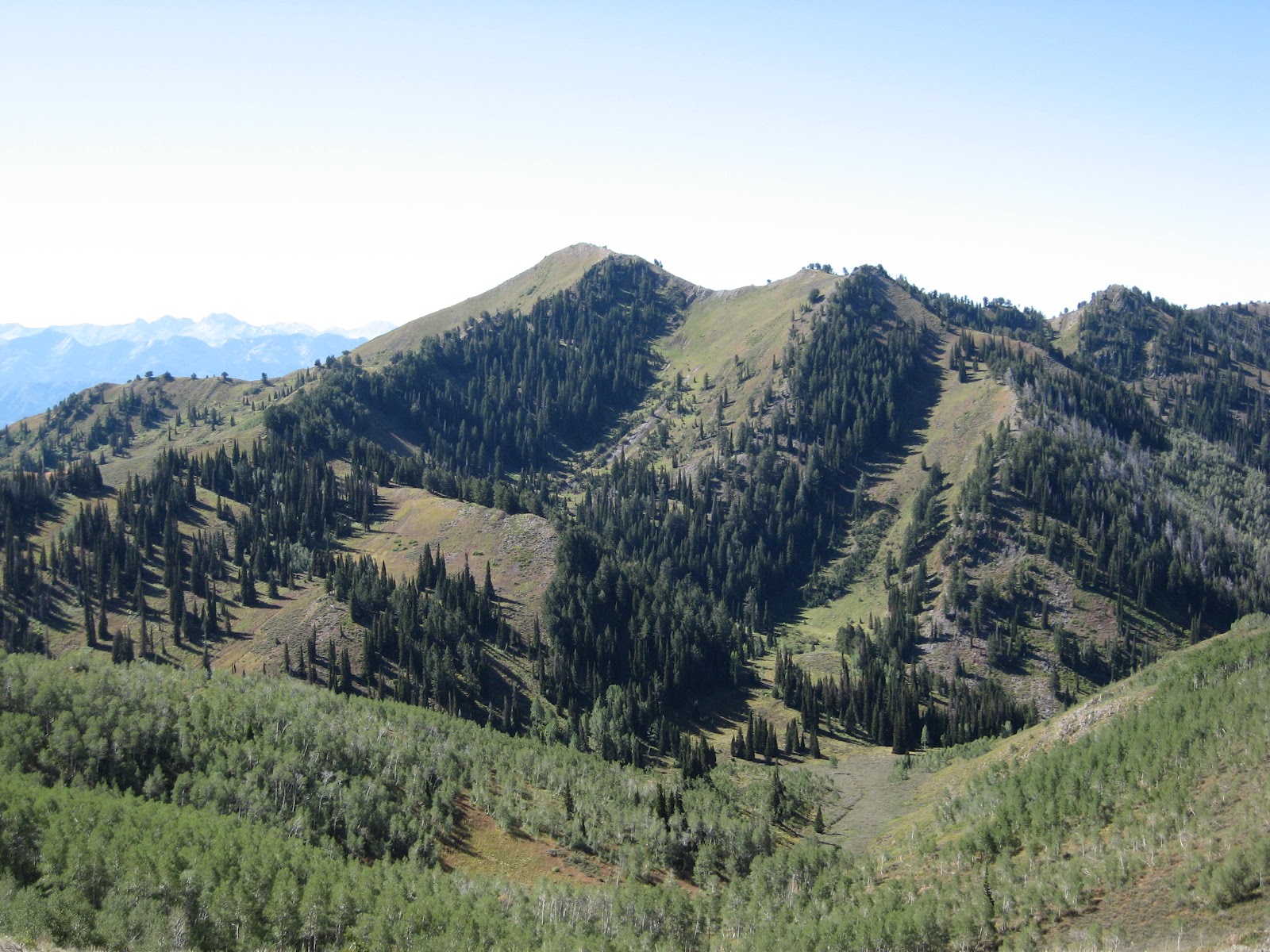
Hiking along the unimproved road now, the route descends approximately 250 feet elevation into a small basin before ascending slightly to a knoll on the other side. It then descends again to reach the trailhead at approximately 8,260 feet elevation. The trail continues its way through mostly wooded country to reach the summit ridge of Sessions Mountain at approximately 9,000 feet elevation. From this ridge, Grandview Peak comes into view one-and-a-half miles to the south-southeast. As the trail heads generally east from this point, it drops about 400 feet to a saddle and then regains this same elevation on the other side. The entire route along the East Sessions Mountain ridge (about 1.1 miles) is unshaded from the sun. At a point near where three counties meet, the final leg of the route involves another drop of about 250 feet before the final ascent to the 9,410-foot summit of Grandview Peak is made. While the initial elevation gain from the starting point to the summit of Grandview Peak is only 930 feet, several decreases and regains in elevation push this value to approximately 2,000 feet. Total distance is approximately 5.0 miles one-way.
 |
| View looking southwest towards the summit of Grandview Peak |
No comments:
Post a Comment