Located at the west end of the Uinta Mountains in northeastern Utah is a popular area known as Mirror Lake. During the summer months, it draws lots of fishermen and recreational enthusiasts from all around to escape city life and cool off from the hot temperatures below. Access to this area is made possible by the scenic Mirror Lake Highway, which features the highest asphalted highway in Utah at 10,715 feet elevation. The road is closed to automobiles and opened to snowmobiles during the winter months. About one mile west-southwest of Mirror Lake is Bald Mountain – so called because of its rounded top that is void of trees. Though not a particularly strenuous hike, its summit is higher than any point in the Wasatch Range. It gives you that feeling of being "on top of the world" upon reaching the summit. Due to its proximity to the Mirror Lake Highway, this hike can become quite crowded, particularly during the weekends – so plan accordingly. It is always wise to check the weather forecast as well as thunderstorms are frequent in the area, especially during the late summer season.

To reach the Bald Mountain trailhead along I-80 from the west, take the exit at Silver Creek Junction (Exit 146) and continue southward along U.S. Highway 189. Take the Park City/Kamas exit (Exit 4) and turn left (eastward) onto SR 248 for approximately 11.5 miles to Main Street in the town of Kamas. Turn left (north) onto Main Street for two blocks, then turn right (east) onto Center Street (SR 150) and continue about 29 miles to Bald Mountain Pass. The trailhead is on the left (north) up a short dirt road to a parking area. From the east along I-80, take the Front Street exit (Exit 5) in Evanston, Wyoming and turn left (east) onto SR 150 heading out of town. Utah is entered after about 22.5 miles where the route changes to Utah 150. Continuing southward for about another 26 miles, the trailhead is reached – where you will turn right (northeast) next to Bald Mountain Pass up a short dirt road. A $6.00 fee is required for a one to three-day recreational use pass that can be paid at the self-service fee box at the trailhead.
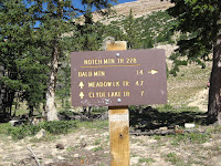 |
Directional sign near the Bald
Mountain Trailhead |
 |
Ascending the trail with the east face
of Bald Mountain in the background |
Before starting on the hike, be sure to carry plenty of water as there are no drinking sources along the entire route. Since there is minimal shade along the trail, it is also wise to wear a hat and use plenty of sunscreen for sunburn protection. Upon leaving the trailhead, the path soon begins to ascend the south slope of the mountain through several switchbacks. There are places where it becomes necessary to climb up rocky steps, so watch your footing. At just over one-half mile, the trail curves onto the southwest ridge and flattens out some through the last patch of low-lying trees. Once out of the trees, the path traverses through an alpine tundra landscape where marmot sightings become common. Near the east face of the mountain, the trail becomes more exposed and steepens as it switchbacks again before reaching the 11,943-foot summit of Bald Mountain. Keep in mind that frequents rests may be necessary due to the thinner air at this altitude. On clear days, the Wasatch Mountains are visible to the southwest and Mirror Lake is visible immediately below to the east along with various peaks of the Uinta Range. Distance from the Bald Mountain trailhead to the summit is approximately 1.4 miles one-way with an elevation gain of about 1,185 feet.
 |
Approaching the final summit
block of Bald Mountain |
 |
View overlooking Mirror Lake
from the summit of Bald Mountain |


