Thursday, October 16, 2014

Wyoming Peak

Back in my earlier hiking days when we lived in Wyoming, there was one occasion when I hiked to the top of Wyoming Peak.  This summit is the highest point in the Wyoming Range of west central Wyoming, and it offers much more peace and solitude than the more popular hikes in the Tetons to the north.  The Wyoming Range is part of the Overthrust Belt that extends through much of eastern Idaho and Utah, and western Montana and Wyoming.  It contains vast amounts of oil and natural gas to feed our continual need for energy.  Yet as efforts to extract these natural resources increases, stricter regulations will be necessary to protect the environment and pristine beauty of the region.  Though not a particularly impressive peak in and of itself, Wyoming Peak offers spectacular views in all directions and is certainly worth climbing.
There are actually two main approaches to Wyoming Peak; one from the Greys River to the west and the other from Middle Piney Lake to the east (which is the route I took).  To reach Middle Piney Lake from U.S. 189 (Front Street) in Big Piney, turn left (west) onto Budd Avenue (SR 350) if coming from the south, or right (west) if coming from the north.  After four blocks turn right (north) onto Nichols Street, which curves westward into Piney Drive past Big Piney High School.  This road eventually turns into Middle Piney Road to the Bridger-Teton National Forest boundary (approximately 20.3 miles from U.S. 189).  At around 1.9 miles past the forest boundary, fork to the left (westward) onto Forest Road 10024 and follow it the remaining 3.8 miles to Middle Piney Lake.  The national forest section of the road is graded dirt that can have snow extending into June.
Middle Piney Lake with the Wyoming Range
in the background taken near the trailhead
Lower Wohelo Falls near the
halfway point along the trail


Near the end of the road next to the Middle Piney Lake Campground is the Middle Piney Trailhead.  For the first mile or so the trail follows near the south shore of the lake, where there are plenty of places to go fishing.  At approximately 1.7 miles the route crosses Middle Piney Creek near the end of a large meadow that extends to the lake.  This area is a prime habitat for bear and moose, and hikers should take the necessary precautions in case of an encounter.  About 2.4 miles along the trail, Wohelo Falls cascades down the mountainside with the lower part of the falls not far from the main path.  The trail then splits just over a quarter-mile beyond Wohelo Falls, where the right fork is taken north for another half-mile to its junction with the Wyoming Range Trail.  Following the Wyoming Range Trail northward (right) will take you above the timberline to a saddle at approximately 10,400 feet elevation.  From the saddle it's about a three-quarter-mile scramble towards the left (west and south) to reach the 11,378-foot summit of Wyoming Peak.  A lookout shelter at the summit was used by fire spotters until the early 1960s.  When I hiked to the summit in 1985 the shelter was in disrepair, but still standing.  More recent photos however, show that this is no longer the case.  Distance from the Middle Piney Trailhead to the summit of Wyoming Peak is approximately 5.1 miles one-way with an elevation gain of just over 2,500 feet.
Shelter at the summit of
Wyoming Peak taken in 1985
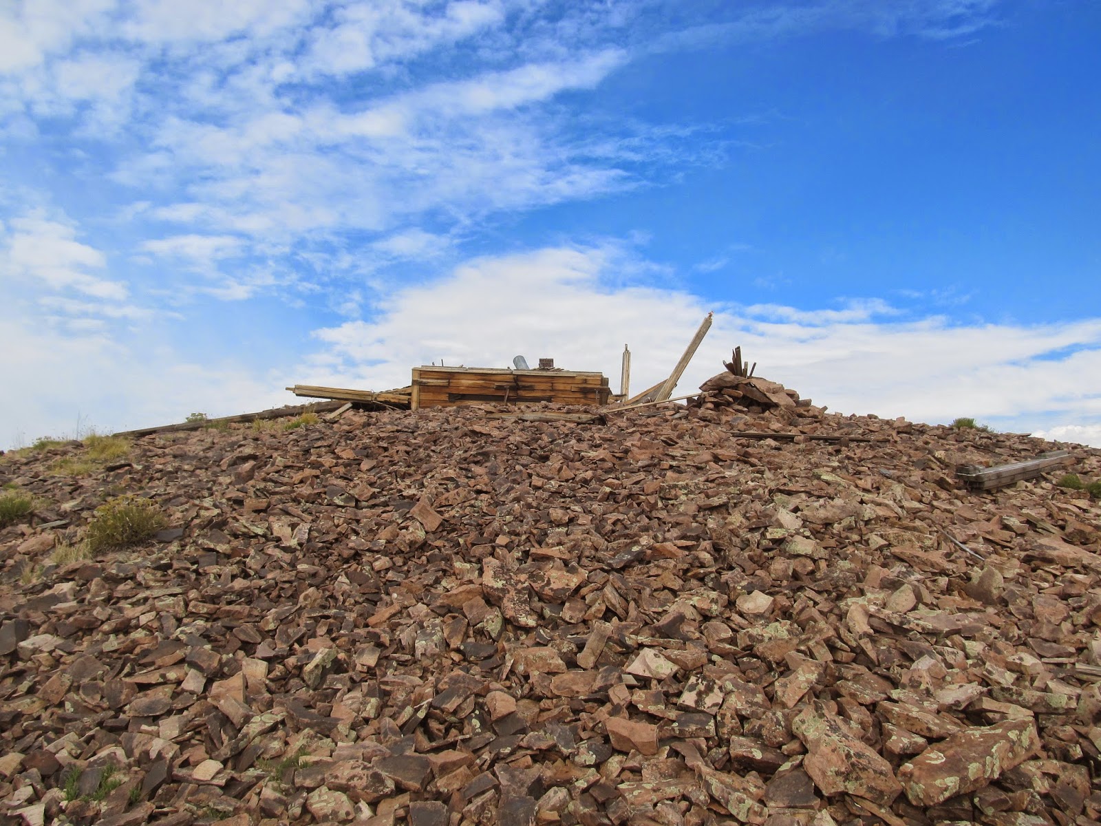
The summit of Wyoming Peak taken
in 2010 – Photo credit: Castlereagh