One of the easiest 10,000-foot peaks to climb in the Wasatch Range is Clayton Peak at the end of Big Cottonwood Canyon. This peak straddles the Salt Lake-Wasatch County line near the upper terminus of the Great Western Express ski lift at the Brighton Resort. It is one of the few vantage points where six world-class ski resorts can be viewed at once. Clayton Peak also offers spectacular views of the Heber Valley, Mount Timpanogos, and the Uinta Mountains to the east. During the time we went up, there happened to be a team of Varsity Scouts at the summit, signaling other scouts with mirrors on some of the surrounding peaks. Clayton Peak can be hiked from basically two starting points; the Lake Mary-Catherine Pass trailhead near the southeast edge of the parking lot at Brighton Ski Resort, and the summit at Guardsman Pass to the north of Clayton Peak.

To reach the Lake Mary-Catherine Pass trailhead from the Salt Lake Valley, take the 6200 South (Exit 6) off of I-215 and turn right (at the light) onto Wasatch Boulevard (SR 190). At Fort Union Boulevard (7200 South), turn left (east) to go up Big Cottonwood Canyon towards the Brighton and Solitude Ski Resorts. Continue driving all the way to the end of the canyon to the Brighton Ski Resort parking area (about 14.6 miles). The trail begins at an information board not far from some resort structures. During the first part of the climb, various service roads that lace through the area will be encountered, making it easy to become sidetracked if you're not paying attention to the general trail path. At around 0.8 miles the trail splits; the left fork goes towards Dog Lake (not the Dog Lake described in the previous post) and the right fork goes to Lake Mary. If more time is available, the extra quarter-mile hike to Lake Mary is certainly worth the effort. To continue on to Clayton Peak, however, the left fork towards Dog Lake is taken. This route continues through a generally forested area for about 1.3 miles to reach Snake Creek Pass, where the Heber Valley area comes into view. Follow the service road that leads northwestward towards the base of Clayton Peak. Upon reaching the base, the trail picks up again for a rocky ascent through a series of switchbacks to the 10,721-foot summit. Distance from the Lake Mary-Catherine Pass trailhead to Clayton Peak is approximately 2.7 miles one-way with an elevation gain of approximately 1,950 feet.
 |
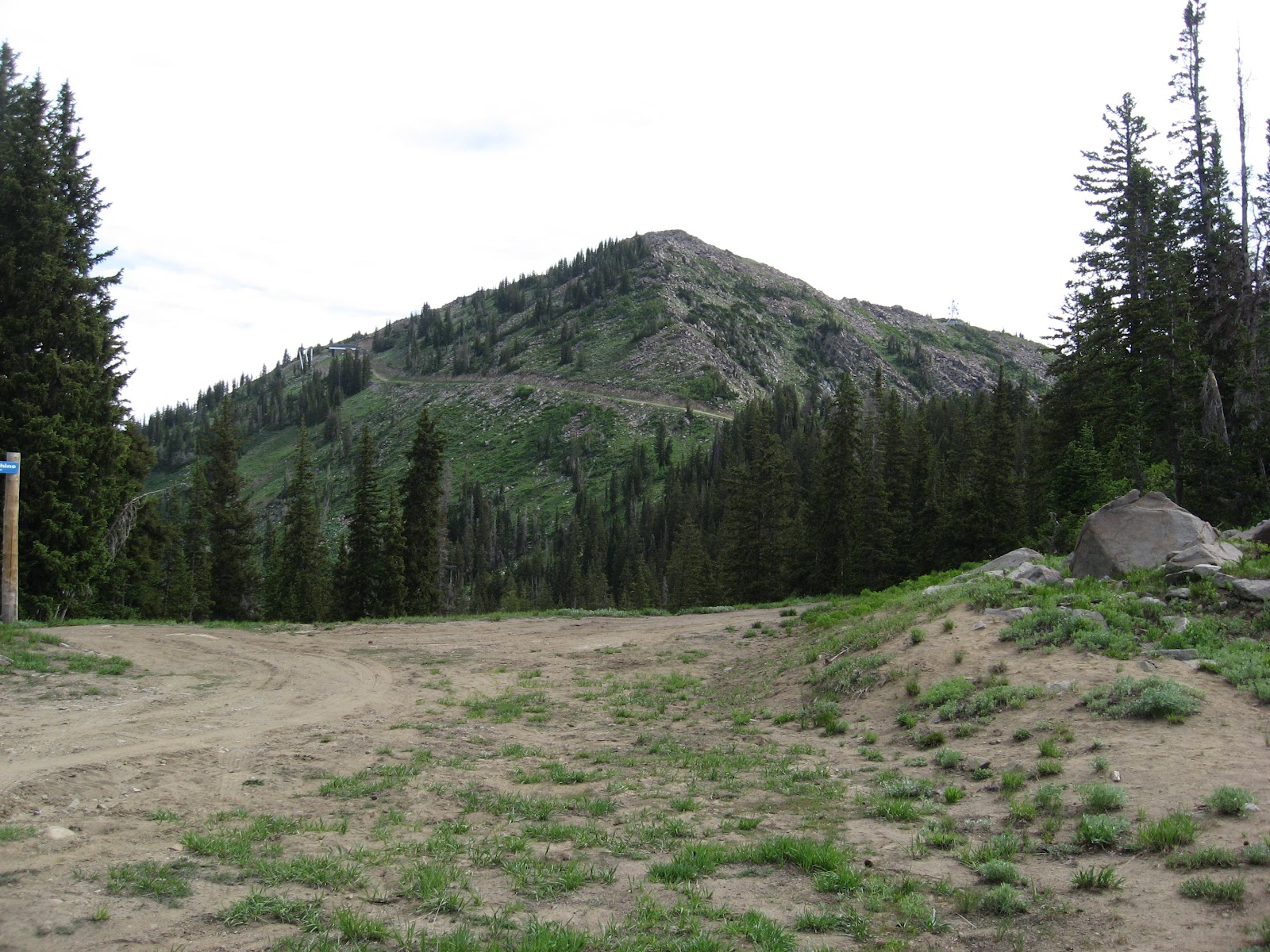
Clayton Peak as viewed from
Snake Creek Pass |
 |
At the summit of Clayton Peak with
Mount Timpanogos directly behind me –
Photo credit: Joe Harline |
For those interested in climbing Clayton Peak from Guardsman Pass, the road to Guardsman Pass splits to the left (east) from the main highway at about 13.9 miles up Big Cottonwood Canyon. Follow this road through several switchbacks for approximately 3.1 miles to reach Guardsman Pass at 9,700 feet elevation. The trail from this direction ascends a steep ridge towards the southwest, and involves skirting around the right (west) side of a false summit (10420) to reach Clayton Peak. Distance from Guardsman Pass to Clayton Peak is approximately 1.4 miles one-way with an elevation gain of 1,021 feet.


No comments:
Post a Comment